![]() Marine Investigation Report 23-10.rar
Marine Investigation Report 23-10.rar
美国国家运输安全委员会(National Transportation Safety Board)周二表示,去年一艘邮轮损坏了阿拉斯加锡特卡附近的一个邮轮码头,原因包括过度依赖电子海图、沟通不畅和过时的航海图。
2022年5月9日,“海洋之光”号邮轮停靠在锡特卡湾邮轮码头时,撞上并损坏了一只系船墩。
这艘邮轮的船体出现轻微凹陷。
系船墩的四根支柱中有三根受损。
船上1375名乘客、782名船员和4名引航员,没有受伤报告。
此次碰撞给码头造成了210万美元的损失,并影响了2022年剩余时间前往锡特卡湾邮轮码头的邮轮交通。
2021年4月,锡特卡海湾邮轮码头码头扩建了395英尺,包括增加了两个由人行道连接的系船墩,并在现有系船墩旁边增加了一个410英尺长的浮船坞。
Sitka Sound邮轮码头没有将扩建行为通知负责更新美国沿海海图的国家海洋和大气管理局(NOAA)。
美国国家海洋和大气管理局没有施工记录,直到NTSB调查人员在联系后通知他们码头的扩建。
在联系时,邮轮使用的电子导航图(ENC)没有显示扩建的码头或增加的系船墩。
“海洋之光”号的船员在很大程度上依赖该船的电子海图和信息系统(ECDIS)来规划和执行对接。
船长和驾驶台团队还有其他导航技术,包括雷达和摄像头,可以帮助他们接近码头。
即使有了这些工具,船员仍然完全依赖ECDIS,这表明ENC不准确。
在靠泊时,水手长和船长没有确认对接期间通信的距离类型。
水手长传递了码头最北端的系船墩的准确距离,但船长错误地认为水手长喊的是船尾经过系船墩时船会有多大的间隙。
美国国家运输安全委员会认为,碰撞的可能原因是船长和驾驶台团队过度依赖电子海图来确定码头相对于他们计划的旋转位置的位置,以及船长误解了船在旋转时船尾的船员所要求的到码头的净空距离。
锡特卡海湾邮轮码头没有向有关的水文当局报告码头延伸到水道的情况,以便更新相关的航海图。
美国国家运输安全委员会的调查人员列举了从调查中吸取的两个教训,即航程规划和港口或码头改造报告。
美国国家运输安全委员会的调查人员列举了调查得出的两个教训,即航程规划和港口或码头改造报告。
报告称:“适当的航行计划包括为航行的每个阶段制定一个完整的计划——从船舶的起始港到结束港(泊位到泊位),包括离开码头和系泊。”
“操纵的参考点应该被识别、精确测量并清楚地报告。驾驶台团队还应确保他们在起航前拥有最新的数据,并就航海图的准确性咨询当地引航员,以确保港口和/或码头的描述是正确的。”
报告称:“港口和码头应立即向相关水文管理局(例如,国家海洋和大气管理局)报告港口或码头配置的重大修改,以便更新海图,并随时向船东、管理者和船员/驾驶台团队提供更改。”
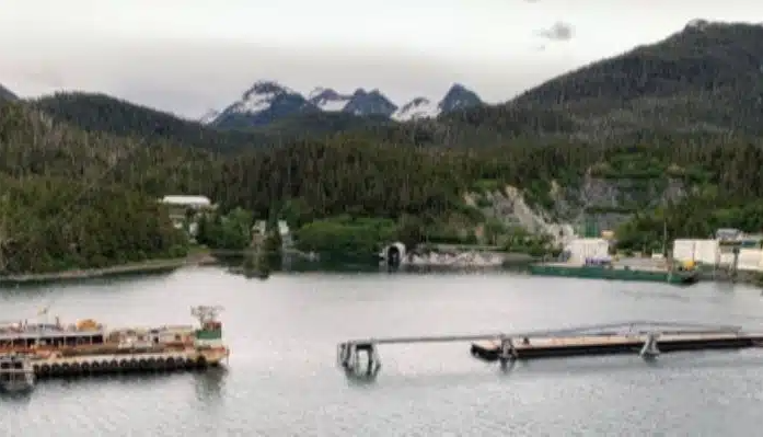
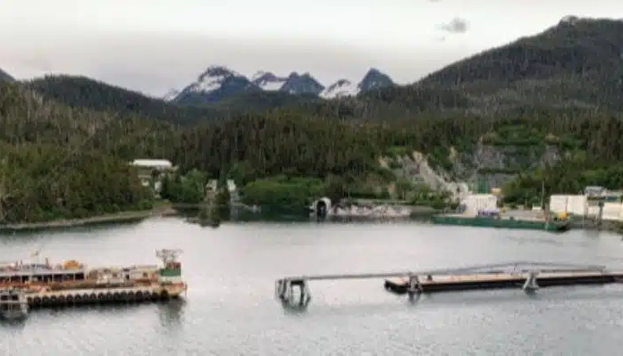
▲The Sitka Sound Cruise Terminal pier is shown on June 9, 2022, with barge alongside the damaged dolphin for repairing (with catwalk removed). (Source: NTSB)
英文原文
Overreliance on an electronic chart, miscommunication and an outdated navigational chart were all factors in a cruise ship damaging a cruise terminal pier last year near Sitka, Alaska, the National Transportation Safety Board said Tuesday.
The cruise ship Radiance of the Seas was docking at the Sitka Sound Cruise Terminal on May 9, 2022, when it struck and damaged a mooring dolphin. The cruise ship sustained a minor hull indentation. The mooring dolphin sustained damage to three of the four pilings supporting it.
There were no reported injuries to the 1,375 passengers, 782 crew and four pilots on board. The contact resulted in $2.1 million in damages to the pier and impacted cruise ship traffic to the Sitka Sound Cruise Terminal for the remainder of the 2022 season.
In April 2021, the Sitka Sound Cruise Terminal pier was extended by 395 feet, including adding two mooring dolphins connected by a walkway and a 410-foot-long floating dock next to the existing dolphins.
The Sitka Sound Cruise Terminal did not inform the National Ocean and Atmospheric Administration (NOAA), the agency in charge of updating U.S. coastal nautical charts, of the extension. NOAA had no record of the construction until NTSB investigators informed them of the pier’s extension after the contact. At the time of the contact, the electronic navigation chart (ENC) the cruise ship was using did not show the extended pier or added dolphins.
The crew of the Radiance of the Seas relied heavily on the vessel’s electronic chart and information system (ECDIS) to plan and execute their docking. The master and bridge team had other navigational technologies, including radars and cameras, available to assist them with the approach to the terminal. Even with these tools available, the crew relied solely on the ECDIS, which showed an inaccurate ENC.
While docking, the bosun and master did not confirm the type of distances that were being communicated during the docking. The bosun was relaying accurate distances to the pier’s northernmost dolphin, but the master incorrectly assumed the bosun was calling out how much clearance the ship would have as the stern passed the dolphin.
The NTSB determined the probable cause of the contact was the master and bridge team’s overreliance on an electronic chart to identify the pier’s position relative to their planned rotation location, and the master’s misunderstanding of the clearance distances to the pier being called by the crewmember on the stern while the vessel was rotating. Contributing was the Sitka Sound Cruise Terminal not reporting the extension of the pier into the waterway to the appropriate hydrographic authority in order to update the relevant navigational chart.
NTSB investigators cited two lessons learned as a result of the investigation, voyage planning and reporting port or terminal modifications.
“Proper voyage planning includes developing a complete plan for every phase of the voyage—from the vessel’s starting port to its end port (berth to berth), including leaving the dock and mooring,” the report said. “Reference points for maneuvering should be identified, measured precisely, and reported clearly. Vessel bridge teams should also ensure that they have the most up-to-date data before getting underway and consult with the local pilot(s) on the accuracy of navigation charts to ensure depictions of ports and/or terminals are correct.”
“Ports and terminals should immediately report significant modifications to port or terminal configurations to the appropriate hydrographic authority (for example, the National Oceanic and Atmospheric Administration) so that charts can be updated and the changes made readily available to vessel owners, operators, and crews/bridge teams,” the report said.
免责申明:本文根据外网内容整理,仅代表作者观点,不代表中国海员之家立场。其真实性及原创性未能得到中国海员之家证实,在此感谢原作者的辛苦创作,如转载涉及版权等问题,请作者与我们联系,我们将在第一时间处理,谢谢!联系邮箱:cnisu@54seaman.com


 联系我们人工客服


 :1391995811


评论 (0人参与)